The changing face of WNC’s national forests
 A million acres of national forests sounds like a lot, and indeed it is. But consider the 8.6 million people who visit the Pisgah and Nantahala national forests every year and those vast green swaths that checker any map of Western North Carolina don’t seem quite so big after all.
Bartram Trail: Mystery tract with no heirs provides critical link for long-distance hiking trail
It took more than a decade, a lot of detective work and a protracted legal case to clear the way for a new portion of the Bartram Trail in Macon County now under construction.
The Bartram Trail Society maintains a 100-mile memorial trail in Western North Carolina in honor of the naturalist William Bartram, who traveled through the region in 1775 on a botanical mission to collect exotic, new-fangled plants from the New World for the English crown.
A large section of the trail in Macon County is stymied either by private land or the Little Tennessee River. Hikers trying to do the entire Bartram Trail have to come out of the woods and hoof it along the highway through Franklin from the Fishhawk Mountains section to the Nantahala section, or they must find a canoe or kayak and boat down the river.
Some 10 to 15 years ago, Burt Kornegay, then president of the Bartram Trail Society, began an effort to cut down on the amount of highway hiking. The Bartram Trail Society wanted to reroute a portion of the Bartram Trail in the Otto community, specifically from its Buckeye Branch exodus in the Tessentee Creek area to Hickory Knoll Road.
“This would knock out several miles of road hiking,” Kornegay said. “We were trying to reduce that.”
Kornegay saw a for-sale sign on one piece of property where the society wanted to reroute the trail. He and his wife went out on a limb, he said, and bought the piece of property for about $17,000 in expectation that the society would buy it from them, which it ultimately did.
“But then, there was still a little weird piece of private land,” Kornegay said. “For some reason, it had just been sort of a lost piece of land and had sat there for all this time, for over 100 years.”
Unsorting the story of that “weird” piece of land — a critical link to get the trail rerouted — became the task of Highlands lawyer Richard Melvin, who donated his time to helping the Bartram Society on the matter.
Deciphering boundary lines and surveys of old tracts are never easy.
“In the old titles, you’ll often find overlap with descriptions to this rock and that tree,” Melvin said. “We had to find out where it lies.”
But, there was a rather unusual hurdle for this particular tract: figuring out who the heck owned it.
“We finally found out the last owner was Nimrod Jarrett,” Melvin said.
Nimrod Simpson Jarrett was a major landowner across Western North Carolina, owning thousands of acres. Jarrett also farmed, traded ginseng, and owned mica and talc mines. He owned slaves and served as a colonel in the Macon County militia. Jarrett lived in the Nantahala community where Appletree campground is today.
In September 1871, Jarrett set off for Franklin from Nantahala on a business trip and was robbed and killed. A man named Balias Henderson was found guilty of the crime and was subsequently hanged in May 1873.
Melvin said he couldn’t determine that there were any heirs to the piece of property in the Hickory Knoll area of Macon County that Jarrett had owned. Melvin said that Jarrett had had children, but that those children had moved west or otherwise left the county and abandoned this particular piece of property. Perhaps he had so much land, the executor of his will couldn’t keep track of it all, and this piece was simply lost in the shuffle. But for whatever reason, the title was still in his name — 150 years after his untimely murder.
The land is surrounded by U.S. Forest Service land on all sides but one.
Melvin filed a quitclaim deed on the land on behalf of the Bartram Trail Society. The group, after the seven required years passed, gained legal title after no one came forward to contest the claim.
Walter Wingfield, current president of the Bartram Trail Society, said the land was then sold to the U.S. Forest Service for its appraised value.
The Bartram Trail Society does not build trails on private land because of liability issues, which is why it sold the property to the forest service. Some of the money from that sale will be used to help build the new 3.8-mile section of the Bartram Trail.
The new property is very steep and rugged, Wingfield said, meaning that private contractors with trail-building equipment will be required, not just volunteer labor. A grant is also being sought to help pay for the new trail.
As for the robbery and subsequent murder of Jarrett that led to this legal quagmire?
“I think the murderer got 50 cents and a pocket watch out of it,” Wingfield said.
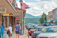
Welcome AT hikers: Franklin gears up for stream of thru hikers with annual Trail Days bash
Susan Sakna and her two dogs were far from their home in Massachusetts. But like many Appalachian Trail thru-hikers, Sakna discovered the perfect temporary respite for the night staying at a hotel in Franklin.
This was an opportunity to rest her weary feet — and the dogs’ weary paws — before tackling more of the nation’s most-famous hiking trail. Stopping in Franklin has become routine for AT hikers such as Sakna.
Franklin serves as a chance to get rid of equipment found to be useless and to stock up on items discovered to be essential. Most of the hikers taking breaks here are about one-week in to their six-month journey; Franklin is 100 miles from the trailhead in Springer Mountain, Ga. This means that Franklin serves as the first place to closely evaluate and correct gear needs and equipment problems.
The AT passes just 11 miles from Franklin at its closest point near Winding Stair Gap.
“It’s very pretty here,” Sakna said as she sat outside a Franklin hotel surveying the surrounding mountains with dogs Max and Shay. Sakna was waiting for a shuttle to arrive and transport her and the dogs back to the AT. “And it’s good to get away from the trail — in some ways, you really can’t even see the mountains when you’re on it because of all the rhododendrons around.”
As AT thru-hikers pour into Franklin at an ever-increasing rate each year, town officials and business owners seem to increasingly relish and appreciate their role as an AT trail destination. Twenty years ago, even 10 years ago, the hikers generally came and went with little notice or fanfare. No more: Franklin, these days, prides itself on having close ties to the AT. And, the town is gearing up for April Fool’s Trail Days on March 30 and March 31, capitalizing on the town’s close proximity to the 2,181-mile long trail stretching from Georgia to Maine.
Franklin as hikers’ paradise
“We see the Appalachian Trail as one of our main economic drivers,” said Linda Schlott, Franklin Main Street Program executive director. “And Trail Days just continues to grow.”
Franklin started April Fool’s Trail Day’s four years ago. In March 2010, the town officially was designated an Appalachian Trail Community at the invitation of the Appalachian Trail Conservancy. Franklin became the first location in the South to receive the conservancy’s designation as an official trail community.
The Appalachian Trail Community designation is a relatively new program designed to promote the economic benefits of the trail to nearby communities and to foster local stewardship of the trail. For its part, Franklin showed its tie to the trail by creating a trail advisory committee, hosting an annual trail event, initiating an AT-focused education program through the school and library systems and getting the county planning department to commit to considering the trail in its land use plans.
Franklin has bigger eyes than just mining the AT, however.
“We’re not only looking at AT hikers but to use this as a base for all hikers,” Schlott said of the town’s trail-friendly status.
Macon County, in addition to the famous AT, has a substantial portion of the Bartram Trail, plus easy access to hundreds of miles of hiking trails within the Nantahala National Forest.
Important economic boost
Rob Gasbarro, co-owner of Outdoor 76 in downtown Franklin, said the gear-heavy store on Main Street gets a lot of AT thru-hiker traffic.
“It’s a big deal for us,” Gasbarro said. “And, Trail Days is a great opportunity to introduce locals to people doing the six-month pilgrimage.”
Down the street at the Life’s Bounty Gift Shop and Bakery and Café, co-owner Tony Hernandez has grown very fond, too, of the thru-hikers — they come in hungering for the carbohydrates, sweets and the breakfast specials offered there.
“Basically, most of my customers this morning all have been hikers,” Hernandez said one day last week. “And, they are wanting lots of carbs or breakfasts.”
Hernandez welcomes the hikers in, packs and all; just as Franklin these days is doing, too.
Franklin a do-or-die town for A.T. hikers
Thru-hikers on the Appalachian Trail — those who attempt an entire 2,181-mile trek from Georgia to Maine, from start to finish — are starting to show up in Western North Carolina.
To finish the trail before the New England winter sets in, hikers must set hit the trail in Georgia in March. Of the 2,000 or so who set out to thru-hike the trail, only 25 percent actually make it. Most drop out the first month. That makes the Nantahala and Smoky mountain ranges do-or-die for hikers — this is the stretch of trail where they decide to either pack it in or keep on packing.
Hikers who hop off the trail in Franklin to restock on provisions will find a little extra encouragement in their trying early weeks with the annual April Fool’s Trail Days on March 30 and March 31. Here’s the lineup:
• Hiker bash at 6 p.m. both nights at the Sapphire Inn on East Main Street. A chance for hikers to connect and share stories and advice.
• Trail Days event from 10 a.m. to 4 p.m. Saturday, March 31, with outdoor gear vendors, food, entertainment and more. There also will be workshops, a rock climbing wall, children’s activities. One of the day’s highlights will be the 2012 Go Outside and Play Road Show presented by Blue Ridge Outdoors Magazine. This exhibit encourages participants to become more involved with their local outdoor community and to inspire spectators to be more active in the outdoors.
828.524.2516 or www.aprilfoolstraildays.com.
Hitting the trail not so easy in Jackson – at least not yet
Thanks to work obligations that have put me in Franklin several days at a time these last few weeks, I've had the opportunity in recent days to run, walk and stagger along that town's greenway.
I know I've plucked on this harp, honked this horn and beat on this drum a few times before, but I'd like to replay an oh-so-familiar tune again: greenways are cool. Greenways are great. Greenways, in fact, are just about the best legacy I can imagine elected officials creating to mark their times served in office.
I write this in the fervent hope that Jackson County will continue in its pursuit of something similar to what Macon County has created. Because if any community could use a greenway, it would be this one: I live just outside Sylva, and I'm here to tell you that this is a hard place to walk and run safely about. Or at least, to do that anywhere enjoyable — running beside the four-lane highway in the bike lanes is not my idea, or many other people's idea, of particularly enjoyable.
Swain County, my home turf, is unusually blessed in that the community has easy access to the Great Smoky Mountains National Park. Go out to Deep Creek any morning and you'll find scores of local residents walking the 4.2-mile roundtrip loop. Those more intrepid souls easily can add harder terrain and distance — Indian Creek Falls, Noland Creek and more. When the lake is down, many residents opt to take their walks and runs along Fontana.
What Swain County lacks is an indoor recreation center. But that's a column for another day.
Haywood County has Lake Junaluska, a great gift to those in the community looking for somewhere safe and scenic to walk and run. Back when I worked everyday in Waynesville, I'd spend early morning hours working out at Lake Junaluska, adding distance and variety by trotting along the roads winding about within the Methodist community.
Sylva is much harder than these other communities for those seeking a place to exercise outside.
Occasionally I simply run and walk the roads in the community where I live. But one gets bored, or I get bored, with doing the same workout day in and day out.
There is a trail around Southwestern Community College. And though I appreciate its existence and on occasion avail myself of that trail, frankly SCC's path would challenge a mountain goat. Some days I'm just not up to that level of workout.
When there's time I drive to the end of Locust Creek Road, navigate through the trash pile at the bottom, and run those rough roads and paths for an hour or so. That's fairly enjoyable, but I do feel odd when I round turns and come face to face with pickup trucks and ATVs with local guys four-wheeling away the day. We just wave and go our respective ways, but I worry I'm in their way and that my presence adds a potential safety issue to their traditional mud-flinging fun.
Western Carolina University, I should certainly mention, is working on a five-mile long multi-use trail.
Keep in mind that volunteers are needed to help with trail construction there this spring and summer and with ongoing maintenance. To that end there's a trail-building workshop on campus Saturday, March 24. The workshop includes a required classroom session in The Cats Den in Brown Hall from 9 a.m. until noon led by a trail care crew from the International Mountain Bicycling Association, plus lunch and afternoon work on the trails. The training will prepare volunteers to build that five-mile trail at WCU for walkers, hikers, trail runners and mountain bikers this spring and summer.
I am concerned about mixing all users together. I used to run regularly at the region's most famous mountain bike destination, Tsali Recreation Area on the Swain-Graham county lines, which has four trails. The trails are open to hikers, bikers and riders on horseback, but on a strictly enforced rotating schedule. I would never have run on a trail with the mountain bikers on a heavy-use day — it would have been dangerous for them and me.
That said, I'm happy to see any trails being built in the area, and I'm sure WCU will work out any kinks in usage as problems, if any, play out.
But what I really hope is that Jackson County moves forward with acquiring the land needed to build a true greenway system. This community, of all of the communities in this region, could truly use one.
(Quintin Ellison can be reached at This email address is being protected from spambots. You need JavaScript enabled to view it.)
New Friends of Panthertown president brings wealth of skills
Margaret Fry Carton of the Cashiers area has been elected president of the Friends of Panthertown, a nonprofit that protects, preserves and promotes Panthertown Valley, a national forest enclave of unusual beauty and stunning natural features near Cashiers.
"We will continue our work to ensure that Panthertown remains a vibrant and protected natural resource for our community, and for the unique flora and fauna the flourishes here," Carton said. "This organization represents a unique partnership between conservation minded individuals and the Forest Service."
Carton, who lives in the Cashiers, retired in 2005 from Coca-Cola Enterprises as the vice president, chief information officer. Before that, she was the vice president of investor relations and planning and managed several financial functions, including investor and share-owner relations, employee communications, financial media relations, and strategic financial planning and analysis. Her husband is an associate professor and department head for entrepreneurship, sales and marketing, and hospitality and tourism at Western Carolina University.
Panthertown is located in the Nantahala National Forest between the mountain communities of Cashiers in Jackson County and Lake Toxaway in Transylvania County. Carton is also the chairman of the Rabun Gap-Nacoochee School Board of Trustees in northeast Georgia. In addition, she serves on the board of the Atlanta Ballet and is a member of the Western Carolina University Computer Information Systems Advisory Board.
Carton is the second president of Friends of Panthertown, succeeding David M. Bates, the organization's first president and co-founder, who passed away last year.
Hikers’ cars hit by thieves: Trailhead safety becomes focus after recent “car clout” convictions
Three Tennessee residents are headed to prison for breaking into a slew of cars at trailheads in Haywood County during a several month period, hitting hiker’s vehicles in the Great Smoky Mountains National Park and the Pisgah National Forest.
The three stole credit and debit cards, and ran up charges on them, while the unsuspecting victims were off happily hiking … often for several days at a time. Other personal items were stolen, too, including a man’s billfold and, most brazenly, a U.S. government credit card from a U.S. Forest Service employee’s vehicle.
Their arrests and subsequent prosecutions have put renewed focus on what you should do, and not do, when parking a vehicle before taking a hike or backpacking trip.
The main thing is to “use common sense,” said avid hiker Cory McCall of Outdoor 76, an outfitter store in Franklin. “These trails do cross roads, and you often leave your car in vulnerable places.”
McCall is currently helping an Appalachian Trail thru hiker try to decide on a safe spot to leave her vehicle in Macon County for an extended period of time. That might not be completely possible, but there are steps hikers such as that can take, according to forest experts.
And here’s what the victims of the relatively recent break-ins didn’t do: they failed to take valuables out of their vehicles.
That meant when the Tennessee trio — Billy Chad Reese, 39, his wife, Christy Leann Reese and Jessica Hope Daniels — systematically smashed the passenger-side windows of cars at trailheads, they were amply rewarded for their criminal intentions. Specifically, they hit trailheads at Big Creek in the Smokies and Max Patch and Harmon Den in the Pisgah National Forest.
They would hit as many as five cars at the trailhead at one time. They would then go back into Cocke County, Tenn. and promptly use the cards to buy everything from cigarettes to jewelry.
When it comes to protecting visitors to the national forest lands and the Great Smoky Mountains National Park, law enforcement officers with both agencies are taking a hold-no-prisoners stance.
And that focus is paying off: In the Smokies alone, more than 100 people in the past decade have been prosecuted for car break-ins, dubbed “car clouts,” at trail heads.
“That makes a big dent,” said Clay Jordan, chief ranger for the Park.
Sure does: The Smokies used to average about 100 car clouts per year. That number dropped to 37 incidents in 2010 and 14 in 2011.
“We have a cadre of rangers and special agents who are very attuned to it,” Jordan said of Park personnel’s attention to trail heads and visitor safety.
That’s true, too, of workers on the Nantahala and Pisgah national forests. Stevin Wescott, who oversees public relations for the U.S. Forest Service in this area, said extensive efforts are oriented toward educating hikers. But, still, the fact remains that “it is pretty clear that theft is probably the most reported crime” in the national forests.
“We are always trying to encourage people to be safe,” Wescott said. “It’s very sad when (theft) happens. Our officers feel terrible for the people.”
Echoing McCall from Outdoor 76, Wescott said that visitors “should try to leave their valuables at home. If they must leave them in their car, tuck them out of site. Bring only the bare essentials.”
That advice holds true on the trail, too, the U.S. Forest ranger said. Tent break-ins also occur.
Smokies Chief Ranger Jordan said law enforcement is able to successfully prosecute most offenders. The crime, which is a felony offense prosecuted in the federal court system, carries a prison term. On average, those found guilty typically receive a six- to 12-month sentence plus three years probation, Jordan said.
The Tennessee man, Reese, pleaded guilty in August and was recently sentenced to serve more than 10 years in prison by a U.S. district judge and pay $23,000 in restitution. Reese received such a stiff sentence because of prior burglary convictions. When arrested, Reese was unlawfully in possession of a handgun. This meant he received an “enhanced” sentence under the federal Armed Career Criminal Act.
His female accomplices are scheduled Feb. 27 for sentencing.
Trailhead-safety tips
• Remove valuables from vehicles.
• If you must leave valuables in vehicles, hide them out of sight in the glove compartment or trunk.
• Scan the trailhead to make sure no one suspicious is hanging about. If they are, consider moving to another trailhead.
• Do not leave a hiking itinerary on your dash. Leave it with friends, family or at a ranger station.
• Don’t back your car into a parking spot. This provides thieves cover to break into the trunk.
Volunteer crews troll the forests to keep trails clear
Next time you hike a trail, pause a minute and give silent thanks to the legion of trail volunteers who have taken up arms and engaged in hand-to-hand combat with the forest, hacking back the undergrowth and clearing obstructive logs.
Volunteer trail crews devoted 28,000 hours of labor in North Carolina’s national forests last year. It often seems like an uphill battle, with the earth constantly trying to reclaim the zigzag of footpaths cut through mountains, but so far crews are holding their own.
“The trails, I think, are really in good shape,” said Mary Gollwitzer, a hiker in Haywood County.
Before Gollwitzer leads a hike for her club — known as the Leisure Hikers — she makes a practice of scouting the trail ahead of time.
“I don’t like to all of a sudden lead a hike and never have gone on it myself. I stay away from that because I don’t know what to expect,” Gollwitzer said.
She might revise the hike plan if the trail is too steep or has large boulders to scramble over, but she’s never ruled out a hike for the club because of maintenance issues.
Volunteer trail crews make sure the cumulative mass of fallen limbs and downed trees don’t eventually overwhelm trails. They build back washed out bridges, repair eroding trail beds, fix soggy sections by diverting water from the trail, and cart out lots and lots of trash.
There are more than two dozen volunteer groups in the mountains that lend their sweat and muscle to take care of trails. The biggest is Carolina Mountain Club, which runs six volunteer trail crews that comb the mountains several times a week fixing problem spots on the trail.
“Our primary mission is to promote hiking in Western North Carolina, and of course, that means we need trails to hike on,” said Marcia Bromberg, president of Carolina Mountain Club.
Carolina Mountain Club logged 17,344 volunteer hours for trail maintenance in 2011, covering about 400 miles of trail.
Carolina Mountain Club is a stickler for detail when it comes to their trail work, approaching their maintenance reports with a level of notation and specificity you would expect from a NASA shuttle launch.
Some trail volunteers pack their handheld GPS unit, able to catalog the exact trouble spot.
“I observed a dead fall at E 36404, N 3946090 whose removal will require a later trip,” crew leader Wayne Steinmetz reported on a trail scouting trip.
Or, “I observed that ice covered the trail at E 365491, N 3946623 (WGS 83 horizontal datum).”
Their trail maintenance log from 2011 goes on like this — for 190 pages — detailing the who, what, when and how of more than 1,200 volunteer work outings held last year by their various trail crews.
“Hiked in from Sunburst on FS 97 and 97H. Cleared several simple downs, repaired tread at two wash locations and lopped rodies and beech sprouts along uphill side of trail,” Paul Dickens wrote in his report of a workday in the Middle Prong Wilderness in Haywood County last January.
Most trail reports are highly clinical in nature, but you can always tell when Becky Smucker’s come through. She can’t resist throwing in a line about the weather and her botanical findings of the day.
“We did a spring scout of Shining Creek Trail …We removed downs, lopped some, fixed some drainage, reworked one major tread problem, removed some fire rings and carried out a little trash. It was a gorgeous spring days, and giant Vasey’s trillium was in bloom,” Smucker wrote in one report from a workday near Cold Mountain in Haywood County last May.
Strength in numbers
Several volunteer trail groups have sprung up to take care of trails in a very specific area, such as Friends of Whiteside Mountain in Highlands, or of a particular trail, like the Bartram Trail Society or Benton MacKaye Trail Association.
One of these hyper-local groups is the Friends of Panthertown in the Cashiers area of Jackson County — a group united by their love for the place known as “Yosemite of the East.”
The idea of small-scale, local groups taking care of their own little slice of trails is a model the forest service would like to emulate in its quest to build a larger volunteer base, said Jason Kimenker, the director of Friends of Panthertown. The group, which numbers 350 members dedicated to the protection and preservation of Panthertown, has about three dozen trail volunteers who turn out for regular workdays.
In reality, a relatively minute percentage of hikers actually volunteer to work on trails. But adding more volunteers to the mix isn’t a simple solution, Bromberg said. Orchestrating trail crews is complicated and time consuming.
“There are various skill levels, everything from trained sawyers and people like me who go out with my loppers and that’s about the best that I’m going to be able to do,” Bromberg said.
While hikers constitute the vast majority of volunteers working on trails, mountain bikers have upped their presence considerably in recent years. Several mountain bike chapters hold regular trail workdays. They concentrate their efforts in popular mountain bike destinations, like Tsali, Bent Creek and DuPont State Forest.
Horseback groups have historically been the least represented in trail maintenance circles but have been pitching in more in recent years.
Where the forest service can’t keep up, “friends of various stripes have come in and taken a piece of the burden off them,” Bromberg said.
The Wilderness Society last year launched a trail crew to focus on maintenance specifically in national forest areas designated as “wilderness.” Wilderness areas are a challenge when it comes to trail maintenance because power tools aren’t allowed, which means no chainsaws.
The Southern Appalachian Wilderness Stewards uses a combination of volunteer and paid trail crews, with the help of a grant from the National Forest Foundation.
“It was birthed to take some of the pressure off the trail clubs, which found they couldn’t support more wilderness designations if they couldn’t take care of their trails,” said Brent Martin with The Wilderness Society’s Southern Appalachian field office in Sylva.
Call of the watershed
The annual fall hike in the Town of Waynesville’s 9,000-acre watershed took place on Saturday Oct. 29. Around 25 stalwart hikers showed up despite the cold, wet and windy Friday overnight and socked-in, iffy-looking conditions Saturday morning, to see and learn a little about this marvelous resource that the town has preserved through conservation easements.
Dr. Peter Bates, natural resources professor from Western Carolina University, and I led the hike. Bates has been involved with the watershed easements from the beginning and has helped lead a team of biologists and scientists in creating the town’s watershed management plan. I highly recommend that anyone interested in learning about the past and present condition of the watershed landscape and/or the philosophy and science regarding the town’s management plan join one of Bates’ hikes.
For my part, I’m there to try and help people see and appreciate the native flora and fauna of the watershed. My trips are “ambles,” not hikes. We may stop to track down a warbler that sang from the treetops or to examine a wildflower or turn a stone alongside a stream bank to see what we can see.
My group, last Saturday, was shuttled in to where Allen’s Creek empties into the reservoir and hiked back out to the treatment plant. It was a relatively easy, mostly flat (for the mountains) hike of between two to three miles. We were greeted by a few snowflakes at the beginning of the hike, but it was short-lived and the clouds gave way to sunshine. The wind, however, buffeted us most of the day, filling the air with colored leaves. There were a few places during the hike, where we could see the mountaintops, covered in hoar frost and gleaming in the sunlight.
We saw some outstanding fall color up close and were able to gain a little appreciation for the subtle differences that can create dramatic red on one maple and golden yellow on another almost side by side. Most wildflowers were spent but it was easy to identify goldenrod, ladies’ tresses and others by the spent flowers and remaining stems. A few asters were still blooming. We saw heart-leaved aster, white wood aster and one large purple (lavender) aster that I immediately thought was New England aster because of its size but in retrospect could have easily been late purple aster, Aster patens. We also found one lingering gentian.
While there were no binocular-toting birders on the trip, aside from yours truly, there was a general interest. I was surprised at some of the lingering migrants we encountered, including Swainson’s thrush, pine warbler and palm warbler. There was also a group of about a dozen blue-winged teal on the reservoir and the juncos and golden-crowned kinglets had already found their way down to the lower elevations.
Despite the cool temperatures, a little stone turning near one of the creeks in the watershed turned up a two-lined salamander. It’s one that I call Eurycea wilderae, the Blue Ridge two-lined salamander, although, I think the whole group (northern two-lined, southern two-lined and blue ridge two-lined) is still in flux as to what may be species, sub-species, races etc. Another amphibian we encountered was a small (this year’s) American toad.
These watershed hikes are always a wonderful way to get outside. And getting outside in these mountains is always an enjoyable experience. If you are a Waynesville resident, these hikes allow you an up close look at this outstanding resource the town (you) owns. The town is charged with protecting its outstanding water quality and that will always be its focus. The town is also cautiously and carefully exploring the future of this watershed and as an informed and engaged resident of the town of Waynesville you owe it to yourself and future generations to learn about the watershed and be a part of shaping its future.
Now to start rumors, I understand that next spring’s hike may offer a brand new option, but the cat’s still in the bag for now.
(Don Hendershot is a writer and naturalist. He can be reached a This email address is being protected from spambots. You need JavaScript enabled to view it..)
Backpackers in the Smokies may soon pay for permits
The Great Smoky Mountains National Park boasts the largest backcountry in the Eastern United States, yet for backpackers hoping to take in a slice of that wilderness with an overnight trip, finding a park ranger to help with logistics can be elusive.
Even seasoned backpackers tackling new terrain in the Smokies are bound to have questions. Where’s the closest water source? What’s the elevation gain? How likely is snow in April?
Yet the so-called Backcountry Information Desk is staffed for only three to four hours a day, and by volunteers at that.
“That phone is constantly busy,” said Melissa Cobern, backcountry manangement specialist with the Smokies. “That’s where we get a lot of complaints, where people have to call and call and call to try to get through.”
Cobern said the Smokies needs to beef up the backcountry desk with fulltime rangers, whose sole job is to help backpackers plan their routes.
It’s not that the volunteers don’t know their stuff. Most are members of the 900 Miler Club, an elite group who have hiked all 900 miles of the park’s trails.
“You are going to get good information when you get on the phone with them,” Cobern said.
But there just aren’t enough of them to keep the desk staffed all day long or handle the volume of calls, not when you consider each call takes 10 to 30 minutes.
The park hopes to hire rangers to staff at the backcountry information desk, as well as hire more rangers to patrol the backcountry. But to do so will take more money, and that has prompted the park to consider charging backpackers for overnight camping.
A meeting to hear from the public on the plan will be held from 5:30 to 7:30 p.m. on Tuesday, August 16, at the Old Oconaluftee Visitor Center at the park’s main entrance outside Cherokee.
Unlike front country campgrounds with picnic tables, bathrooms and running water, backcountry sites are usually miles from nowhere, scattered across the park’s vast half a million acres and some embedded so deeply in the wilderness it takes three days to reach them from the closest trailhead.
Backpackers in the park have to camp at one of 100 designated backcountry sites, intended to limit impacts on the wilderness.
“The rest of the park is so dense and so steep, you can’t just throw down anywhere. The park would be a mess if people did that,” said Bob Miller, a spokesperson for the Smokies.
The backcountry sites have no amenities other than a fire ring and cables to hang food out of reach of bears.
The Smokies is hardly plowing new ground. All the big parks out West — Glacier, Yellowstone, Zion, Yosemite, Denali and so on — charge a fee for backcountry camping.
But the plan to charge for backpacking here could hurt “the common man,” said Tom Massie, a fisherman who frequents the Smokies.
“In these tough economic times there are families that can’t afford to go to Myrtle Beach or a big vacation somewhere else, so they take their vacations fishing or camping in the Great Smoky Mountains National Park,” Massie said. “The park systems have already been bought and paid for by the citizens of this country, particularly this park. What we are doing is making people pay to use their own national park.”
Whether to charge, and, if so, how much, is one thing the Smokies rangers want to hear from the public.
The park has floated a few options to jumpstart discussion. At the high end: $5 per person per night plus a $10 reservation fee covering the entire group no matter how large or how many nights. At the low end: just $4 per person per night with no reservation fee.
Unless the fee plan goes through, the park isn’t willing to reallocate existing rangers to backcountry assignments.
“Front country has always gotten more attention than the backcountry,” Miller said of the Smokies.
While the Smokies is the most visited national park in the county with around 9 million visitors, only a small fraction come to backpack.
In 2010, there were 33,000 backpackers and a total of 79,480 backcountry nights — meaning each of the 33,000 backpackers averaged 2.5 nights in the woods.
Overnight backpacking is down from 20 years ago, but has started to climb back up in the past five. There were 92,000 backcountry nights in 1994. It dropped to a low of 70,00 backcountry nights in 2006, and is now back up to 79,480.
All the park’s backcountry sites have limits on how many people are supposed to camp at them a given night, ensuring the wilderness experience backpackers are expecting and limiting human impact.
About one-third of the park’s more popular backcountry sites already require reservations to prevent overcrowding. Those are currently taken over the phone, and can be equally frustrating for backpackers trying to get through.
The rest of the park’s backcountry sites require simple self-registration. Backpackers pause at a registration box found at each trailhead, fill out a slip and drop it in the slot before being on their way.
There’s no way for park rangers or other backpackers to know how many people ahead of them or behind them might also have plans to camp at that site.
“A lot of those self registration sites aren’t that popular, but you could certainly end up in the situation where there are a lot of people at that site and there would be more people than you find comfortable,” Miller said.
A more formal reservation system would solve that problem. But it could also complicate matters for the last-minute backpackers, those who live in nearby communities and want to make an overnight jaunt to their favorite trout stream.
Under the new system, they would either have to go online before leaving the house and print out their permit, or get in the habit of planning trips in advance so the permit can be mailed to them.
Their only other option is make a trip to a staffed visitor center that can issue backcountry permits, which would be out of the way for backpackers heading into outlying areas like Cataloochee or Fontana.
Along with beefing up the backcountry information desk, Cobern said the park equally needs more backcountry presence and ranger enforcement.
While backpackers are supposed to get reservations for the more popular sites, some don’t with little threat of being caught.
This frustrates those who have actual reservations, who arrive at the site to find there isn’t enough room, Cobern said.
The most serious problem, however, is there aren’t enough bear cables for everyone to hoist their food off the ground, and that leads to bear problems, Miller said.
Feeling dumb – go take a hike
A recently published study in Proceedings, an online medical journal of the National Academy of Sciences, suggests that regular aerobic exercise like walking or hiking can improve the brain’s memory function and perhaps lessen the risk of dementia. As humans age, the hippocampus — the part of the brain involved in memory forming, organizing, and storing — tends to shrink, leading to impaired memory and increased risk of dementia.
The study published in Proceedings took 120 older adults with no dementia and separated them into two groups of 60. One group participated in a stretching program and one group participated in an aerobic exercise program for a year. Magnetic resonance images were collected at the beginning of the program, at the six-month point and at the end of the program. Those images showed that the stretching group demonstrated a loss in volume of the left and right hippocampus of 1.40 percent and 1.43 percent respectively. The group that participated in regular aerobic exercise, on the other hand, showed an increase in the left and right hippocampus of 2.12 percent and 1.97 percent respectively. According to the study, “… we found that, in the aerobic exercise group, increased hippocampal volume was directly related to improvements in memory performance.”
The study goes on to state — “In sum, we found that the hippocampus remains plastic in late adulthood and that 1 y [year] of aerobic exercise was sufficient for enhancing volume. Increased hippocampal volume translates to improved memory function and higher serum BDNF [brain-derived neurotrophic factor that helps support the survival of existing neurons and encourage the growth and differentiation of new neurons and synapses]. We also demonstrate that higher fitness levels are protective against loss of hippocampal volume. These results clearly indicate that aerobic exercise is neuroprotective and that starting an exercise regimen later in life is not futile for either enhancing cognition or augmenting brain volume.”
Need more reasons to take a hike?
A scientific study from the university of Rochester noted a 20 percent increase in energy for people who spent a minimum of 20 minutes a day outdoors as opposed to individuals who exercised indoors. The brain generates natural mood enhancers like serotonin, dopamine and norepinephrine when stimulated by aerobic exercise like hiking.
The study in Proceedings can be added to a long list of reports and research that point out how beneficial outdoor recreation is, in general to our physical, mental and spiritual well being. But this study concerning the reversal of memory loss may have special significance to many of us. Just think, a regular routine of walking/hiking 30 minutes or so, three times a week and soon we will no longer need to take that GPS with us so we can find our way back to the car.
(Don Hendershot is a writer and naturalist. He can be reached a This email address is being protected from spambots. You need JavaScript enabled to view it..)